
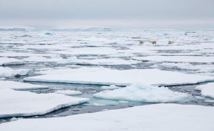
Climate change in the Arctic means the far north of our planet is warming faster than many other places, and that is changing the ice, the oceans, and the animals and people who live there. Picture a giant white cap sitting on top of the Earth. That cap is sea ice, and it grows each winter and shrinks each summer.
So what’s different now? Satellites have watched Arctic sea ice since 1978, and they show how small the ice gets at its yearly low point. In 2026, it reached its minimum on Sept. 12, at 1.78 million square miles (4.60 million square kilometers). NASA and the National Snow and Ice Data Center analyzed the data. That minimum tied for the 10th lowest in the nearly 48 years of satellite records.
Why should a kid in a classroom, or a parent at the kitchen table, care? Because the Arctic is part of one big, connected planet.
Ready to explore? Grab your imaginary snow boots. We’ll look at how Arctic ice works, what’s changing, and how scientists keep watch from space.
What Does Climate Change in the Arctic Mean?
Have you ever looked at a globe and wondered what’s at the very top? That’s the Arctic, the region around the North Pole. It includes the Arctic Ocean, floating sea ice, and lands that belong to several countries, including Canada.
Can you find the Arctic on a globe? Put your finger on the top and slide it down toward Canada. You’ve just found a big piece of Earth’s geography!
Here are a few words that help explain this topic:
- Arctic
- The cold region around the North Pole, made of ocean, ice, and land. Think of it as the top of the planet, like a hat sitting on Earth’s head.
- Weather
- What the sky and air are doing right now, like rain, sun, or snow. It’s like deciding what to wear this morning.
- Climate
- The usual weather in a place over many, many years. It’s like knowing your whole closet is full of winter coats, not just what you picked today.
- Sea ice
- Frozen ocean water that floats on top of the sea. It’s like ice cubes floating in a giant glass of water.
- Satellite
- A machine that circles Earth high above us and takes measurements. It’s like a camera floating in space that keeps watch.
So what does climate change in the Arctic mean? One warm day is just weather. Climate change is about a long-term pattern, where temperatures slowly shift over many years. In the Arctic, that pattern is a warming one, and it can change the ice, the ocean, and the land.
If you’re curious how people compare the two ideas, you can read about global warming vs climate change. Next, let’s see how scientists watch the Arctic’s ice!
How Does the Arctic Warm Up and Lose Its Ice?
The White T-Shirt, Black T-Shirt Trick
Imagine two T-shirts sitting in the bright summer sun. One is white and one is black. Which would feel hotter if you put it on? The black one, right? Dark colors soak up sunlight and turn it into warmth, while white colors bounce a lot of it right back.
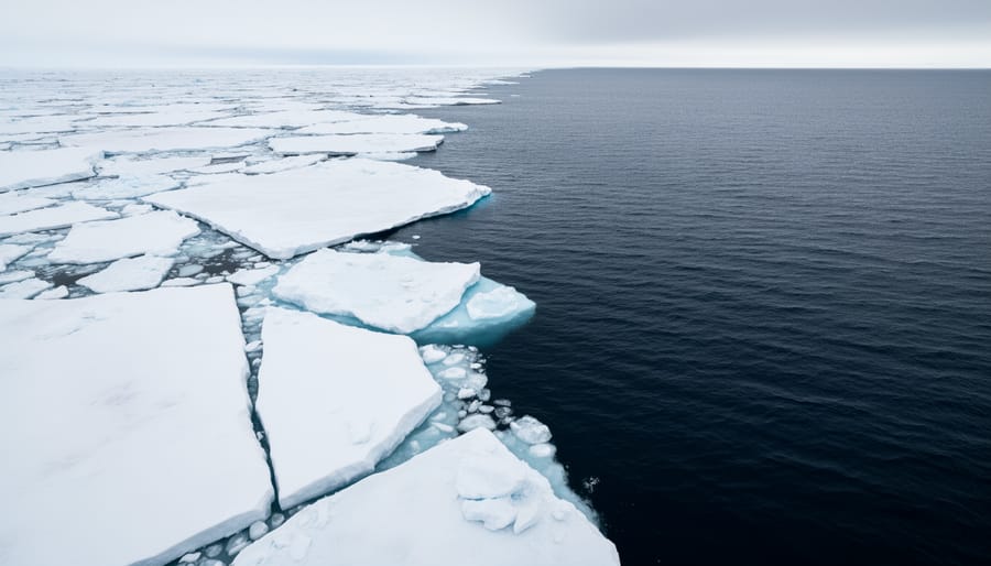
The Arctic works a bit like this. Sea ice is bright and white, so it reflects lots of sunshine back toward the sky, like the white T-shirt. Dark ocean water is more like the black T-shirt, because it soaks up the sun’s warmth. When ice melts and more dark water shows, the water can take in more warmth, which can help the area warm even more.
Scientists track this change each year, including the sea ice September minimum when the ice shrinks to its smallest size.
Try it at home: put a white paper and a black paper in the sun. Which one feels warmer after a few minutes?
Why Scientists Watch Ice From Space
Have you ever wished you could peek at the top of the world without bundling up? Scientists do something close to that. They use satellites that circle high above Earth and watch the Arctic sea ice from space.
These satellites carry special sensors called passive microwave sensors. Think of them as super-eyes that can “see” ice even in the dark of polar winter, when the sun doesn’t rise for months. Regular cameras need light, but these sensors don’t, so the ice never goes missing from view.
Here’s the neat part. Scientists have been using this kind of satellite-based monitoring continuously since 1978. That’s a very long time to keep a steady watch! You can explore the passive microwave satellite record yourself to see how it works.
Who studies all this information? NASA and the National Snow and Ice Data Center at the University of Colorado Boulder analyze the satellite data. They are like detectives, checking the clues from space.
Why do you think watching for so many years is so helpful?
What Did the Arctic Sea Ice Look Like in 2026?
Every year, the Arctic sea ice shrinks all summer and then stops at its smallest size. Scientists call that smallest size the “minimum.” In 2026, the Arctic sea ice reached its minimum on Sept. 12.
So how big was the ice on that day? It measured 1.78 million square miles, which is 4.60 million square kilometers. That’s a huge area, even at its smallest. Can you picture a patch of frozen ocean that big floating near the top of the world?
Now for the “10th-lowest” part. Imagine lining up every year’s minimum from smallest to largest, like a row of different-sized pancakes. The 2026 minimum tied for 10th place from the small end. Scientists have measured the ice from satellites for nearly 48 years, so that’s a long line of pancakes to compare! Tied means another year had the same size, so they share the spot.
Who figured this out? NASA and the National Snow and Ice Data Center (NSIDC) at the University of Colorado Boulder studied the satellite data.
Here’s a fun question to try with a friend: if you could ask the satellites one thing about the ice, what would it be?
What Changes Are Scientists Watching in the Arctic?
Scientists don’t watch just one thing in the Arctic. They keep an eye on lots of parts at once, because each one tells a different piece of the story. Here are the main ones:
- Sea ice: frozen ocean water that floats on top of the sea.
- Glaciers and ice sheets: big layers of ice that sit on land.
- Snow cover: the blanket of snow that covers the ground in winter.
- Permafrost: ground that stays frozen all year long.
- Ocean and wildlife habitats: the cold waters and homes where Arctic animals live.
Why does each one matter? Sea ice gives animals like polar bears and seals a place to rest and hunt. Ice on land is different, because when it melts, the water can run into the ocean. Snow is bright and helps keep the ground cool. Permafrost works a bit like a giant freezer under the soil, holding the ground steady. And the ocean and its wildlife are all connected, so a change in one place can matter in another.
Time for a quick quiz! Is sea ice floating on water or sitting on land? Think about it, then check! Here’s a clue: remember that sea ice is frozen ocean water, so it floats. Glaciers and ice sheets are the ones that sit on land.
Spotting changes in all of these parts helps scientists see the bigger picture of what’s happening up north. Which part of the Arctic would you most like to explore?
How Do Scientists and Communities Use Arctic Climate Information?
When scientists keep an eye on the Arctic, they’re not just collecting numbers for fun. The information gets used in lots of useful ways. Let’s explore a few!
Scientists use satellite data and sea ice measurements to track change over time. Satellites have been watching Arctic sea ice with passive microwave sensors continuously since 1978, so there’s a long record to look back on. Groups like NASA and the National Snow and Ice Data Center (NSIDC) at the University of Colorado Boulder study that data. Japan’s space agency, JAXA, also shares water-related products made from AMSR2 data on its GCOM-W1 satellite. That’s another example of space-based observing.
Why does this matter for you? Teachers and students can use the same kinds of facts to learn about our planet. And people who live in or study the Arctic, including in Canada, can use this information to understand and plan around the place they call home.
Government agencies work on climate and environment topics too. One example is Environment and Climate Change Canada (ECCC). It has been reported that more than 800 ECCC positions will be cut as part of a federal plan to reduce the public service by 15 per cent over three years.
Want to try this at home or in the classroom? Here are some ideas:
– Map time: Find the Arctic on a globe or map. Which countries touch it? Can you spot Canada?
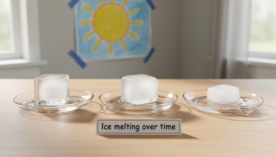
– Ice cube experiment: Put one ice cube in the sun and one in the shade. Which melts first? Why do you think so?
– Ice record chart: Draw a simple chart of the 2026 minimum, 1.78 million square miles, and talk about what “10th-lowest” means.
What would you measure first if you were an Arctic scientist?
Quick Questions About the Arctic and Its Ice
When was the 2026 Arctic sea ice minimum reached?
Scientists saw the smallest amount of ice on Sept. 12. After that, the ice started growing again as the Arctic got colder.
How low was Arctic sea ice in 2026?
At its smallest, the ice covered 1.78 million square miles (4.60 million square kilometers). That tied for the 10th-lowest minimum in the nearly 48-year satellite record.
What organizations monitor Arctic sea ice?
NASA and the National Snow and Ice Data Center at the University of Colorado Boulder studied the satellite data for 2026. Japan’s space agency, JAXA, also shares water-related satellite products from its GCOM-W1 satellite.
What does climate change in the Arctic mean for Canada?
Canada has a large Arctic region, with many communities and ecosystems that call it home. That’s why Arctic science matters to people far beyond the North Pole.
Want to dig deeper after these quick answers? A good next step is to look at what the wider science community says. This UN climate report explains how our whole planet is changing, and the Arctic is one big piece of that puzzle.
Here’s a fun challenge for your next map time. Can you find the Arctic Ocean and then spot Canada’s northern edge? Grab a globe, point to both, and see how close the two are.
So, here’s the big picture, friends! The Arctic, that super-cold top of our planet, is slowly getting warmer. Scientists keep a close eye on its sea ice by using satellites that look down from space, and they have done this since 1978. This year, the Arctic sea ice minimum came on Sept. 12, when the ice shrank to its smallest size of the year.
Learning about the Arctic helps us understand our whole world, and you are already part of that adventure! Every curious question you ask makes you a better explorer. Want to do even more? Check out how kids can help care for our planet, one small step at a time.
Now it’s your turn to think like a scientist. What question about the Arctic would you ask one? Grab a globe, try our geography quizzes and activities, and keep exploring!